


01: Ocean Systems
Between The Lines - Ch 01: Profiles
Success in game fishing is much more than an exercise based on applying science and technology. The most successful game fishermen have an ability to make decisions based on what is best described as their ‘hunting instinct’. It is a method of thinking and interpretation.
Stated simply, at the crux of this is the ability to break a system down to its basic components. You can then analyse each aspect of a system independently. When you again look at the overall picture, you’ll have a better understanding of all aspects of the systems involved.
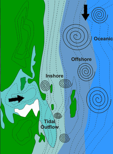
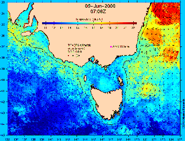
The image here shows a map of an area which could represent any body of water. The green island, the pale blue is water, the white a sandbar and the contour lines show changes in depth. At this stage it doesn’t matter if you see it as a creek entering a river, a river entrance to a lake, bay, river or harbour entrance to the ocean. Working out where the fish are is pretty much the same in all these scenarios.
To start the analytical process, we need more information, such as which way the currents are running. The currents interact with each other due to land masses, depth changes, winds, tides and temperature. In fact, just about everything that comes into contact with bodies of water affects them to some extent.
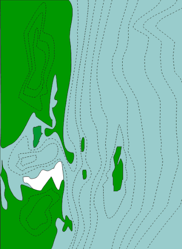
We’ll imagine the current is coming from the top of the page, we’ll call it north, and there’s another coming out of the smaller body of water which we’ll call tidal outflow.
Obviously, where the two currents meet they will interact. Shown here is the smaller current being pushed to the south as would be the case in a run-out tide from a harbour into the sea.
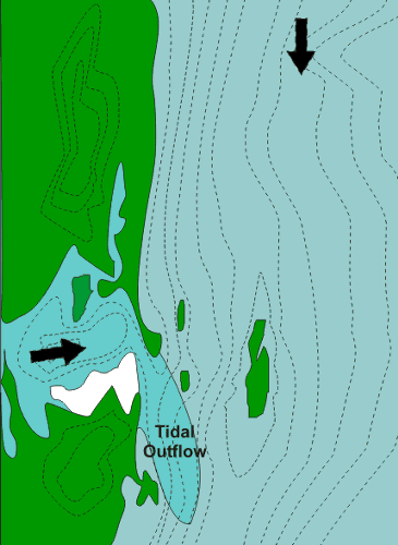
The action of the main current flowing along the shoreline would mix the water so there would be several zones. The closer the water to the shore the dirtier it is, as the bottom is scoured, or silt from another system, such as a river, is mixed in. The further away, the cleaner it is. The difference in other factors such as temperature, speed, oxygen and living organisms depends on the season and where the currents are coming from.
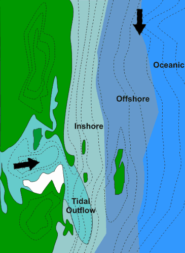
In this case, we’ll call the zones inshore, offshore and oceanic. As these currents flow and interact with each other and different formations, the friction causes some of the areas to spiral or eddy as shown in the next image.
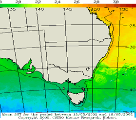
These eddies are caused by the friction of the water both on and below the surface. And it is in these areas, especially the edges that contain the greatest mix of nutrients, oxygen levels, and temperature variances. It is along these edges that the chain of life is found, starting with phytoplankton, followed by baitfish, which are also small predators, up to the giants of the oceans.The edges of these currents and eddies are considered important enough to spend a great deal of effort to monitor. Many government departments do just this, the CSIRO in Australia, which makes available images such as the image to the right. This is an image of an SST (Sea Surface Temperatures) graph which shows the currents along the east Australian coast identified by temperature difference, indicated by colours.
The images can be grouped over a period of time to show a complete picture of how the currents and eddies flow and spiral down the coast. At this stage it’s important to realise by looking at something as simple as a chart or map, with just a little information, you can ascertain what is likely to be happening and where the fish will be. It is also important to realise the ocean is a living entity that is more bountiful than any zone on land. We have to think of where you would expect the jungles, rain-forests and savannas of the ocean to be found.