


3. GPS, Radar and Autopilot
Between The Lines - Ch: 11 Finding Fish
|
Rather than go through individual items individually as they will certainly be out of date in a very short time, we'll explain the process with a scenario of how these tools would be used during a typical day. Although we usually have a pretty good idea of our destination, we still need to keep an eye out for signs both on the surface and on the sounder which may need tweaking of the gain and STC (I'm intentionally not explaining how to do this as it is in the manual which you should go through!) to show a clear picture at cruising speed. If there are signs in an area that you wish to investigate the process is as follows. - Mark the spot with a waypoint at ships position. - Slow down to trolling speed. - While the crew is deploying the lures zoom in the chart to around three miles or smaller. By zooming in the chart you will get a much more accurate track to waypoints. - Zoom the sounder in to show surface to 30-metres. - Check your direction relative to the current by comparing speed through the water to SOG - Speed Over Ground - as long as your SOG is greater than water speed you are going with the current, not against it. Note there are other considerations that are taken into account that have been dealt with elsewhere. When repositioning to the original or subsequent waypoints zoom right in on the chart or use ‘go to cursor' or ‘go to waypoint' to accurately get back to the spot. (Vid 1)
This is the routine whenever a likely spot is encountered. Once you get to the area you have chosen to spend some time looking at, you would work it in a search or grid pattern to cover the area thoroughly, zig-zagging down the current and working straight back up current to reposition. Once a promising area is found you would then position the boat for the best run in the area. That is down current across the edge of the area without going into the sun if it is low such as in the early morning or late afternoon.
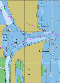
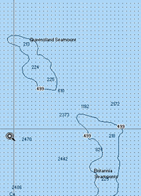
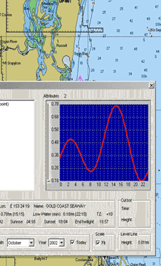
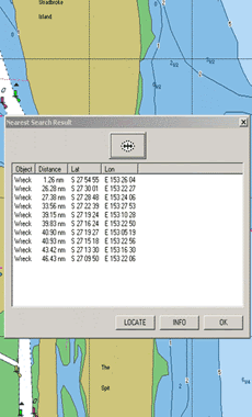
These systems are so simple to explain and easy to execute because the system functions so well and intuitively, giving information when required. The system also does many other things that are useful in helping you find more fish. The C-Map electronic charts are full of information, not only the charts which show structures, bottom soundings and contours, but also the local tide times, wreck positions, fuel supplies and a host of other useful information. (Fig 4 to 6)
The radar, apart from its obvious safety feature, such as showing objects in your path that you should avoid, it has several other advantages when used on its own or in overlay mode on the GPS chart screen. By showing other boats in your surrounding area relative to the chart, you can easily move your cursor over them and hit the save waypoint at cursor if you notice a puff of smoke as they get a shot, or notice if they are working a show of bait, or if they have come on the radio saying they've had a bite or found bait. If they have forgotten to mark the spot in all the excitement, you can tell where it was. (Vid 2)
The radar can also identify different wave patterns at distance showing a likely current line, plus when tuned in, will show concentrations and flocks of seabirds. Just as with every other subject we have discussed, using any tool to anywhere near its potential takes time. It is a process of going through the manuals and practising the system until you are comfortable working with it. Spending the time to use electronics such as the Raymarine units mentioned here - powerful tools that can certainly help you catch more fish - is a small amount of time well invested to get the most out of them. It forms part of the effective arsenal of gear and knowledge that is all part of game and sportfishing today.
|